MONTIGNIES-SUR-SAMBRE (BE) - 2011-12-20 18:55:18
- Magnitude 1.2
Last update : 2020-12-04 14:03:09 Belgian time
Main parameters
| Date and time |
2011-12-20 18:55:18 UTC
2011-12-20 19:55:18 Belgian time |
| Type | Earthquake |
| Magnitude | ML 1.2 |
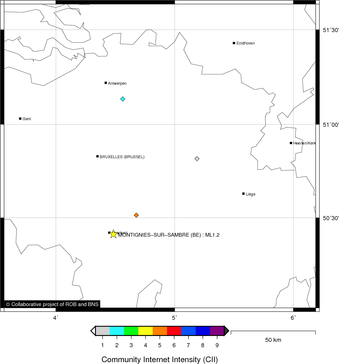
| Region | MONTIGNIES-SUR-SAMBRE (BE) |
| Epicentral coordinates | 50.407° N, 4.494° E Uncertainty ± 0.8 km |
| Depth of hypocenter | 5.8 ± 2.6 km |
Data source : ROB (Royal Observatory of Belgium)
Location map
Quake measurements
Measurements by the Belgian seismic network
| Station | Epicentral distance (km) |
P-Wave arrival (hh:mm:ss.ss) | S-Wave arrival (hh:mm:ss.ss) | Maximal ground displacement (nm) |
|
|---|---|---|---|---|---|
| Code | Place | ||||
| SNF | SENEFFE | 19 | 18:55:21.84 | 18:55:24.15 | - |
| MRD | MAREDSOUS | 23 | 18:55:22.00 | 18:55:25.09 | 23.6 |
| CSE | COURT-SAINT-ETIENNE | 23 | 18:55:22.85 | 18:55:25.63 | - |
| RQR | RONQUIÈRES | 29 | 18:55:23.61 | 18:55:27.43 | - |
| DOU | DOURBES | 35 | 18:55:25.09 | 18:55:29.36 | 20.2 |
| SKQ | STEENKERQUE | 40 | 18:55:25.37 | 18:55:30.15 | - |
| GES | GESVES | 42 | 18:55:25.51 | 18:55:31.16 | - |
| CTH | COUTHUIN | 46 | 18:55:25.87 | 18:55:31.71 | - |
| LES | LESSINES | 57 | 18:55:28.25 | 18:55:35.07 | - |
| CLA | CLAVIER | 57 | 18:55:28.39 | 18:55:34.87 | 3.9 |
| BOU | BOUGNIES | 39 | - | 18:55:30.08 | - |
| MEMH | MEMBACH | 110 | 18:55:37.69 | 18:55:51.04 | - |
| KLB | KALBORN | 120 | 18:55:39.03 | 18:55:52.46 | - |
| VIA | VIANDEN | 133 | 18:55:40.43 | 18:55:56.70 | - |
| STI | SART TILMAN | 78 | - | 18:55:43.28 | - |
Macroseismic
Data
| Total number of responses | 3 |
|---|---|
| Intensity I | 1 |
| Intensity II | 1 |
| Intensity V | 1 |
Attention! The intensities derived from the macroseismic enquiry are raw unverified data.
Map
Data policy
Please read on this notice to learn more about our data policy.